June 2026 · 9 min · By Zain Karim
Driving the Karakoram Highway: The Honest Brief
One of the world's great roads, in plain terms, how long it takes, where to break, what to avoid after dark, and what the road actually feels like.
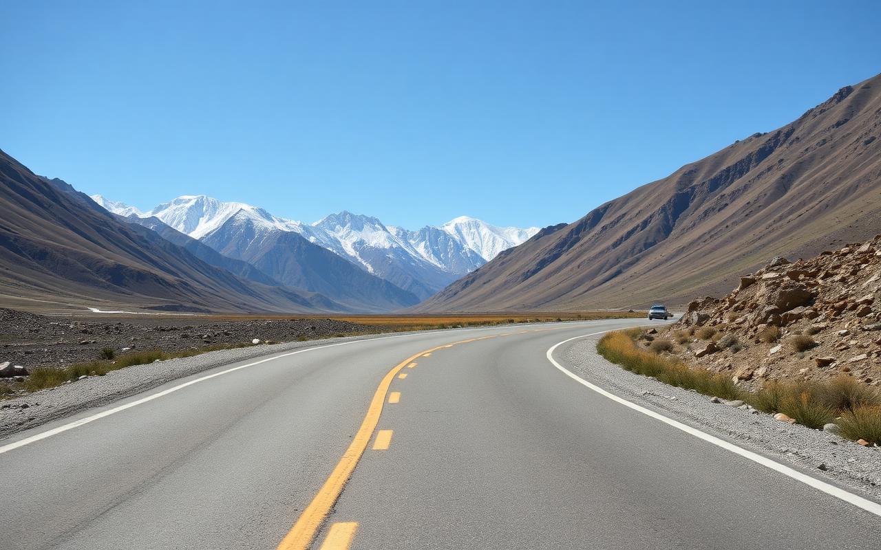
Driving the karakoram highway is, for many of our clients, the trip's defining experience. The KKH runs roughly 1,300 km from Hasan Abdal near Islamabad to the Khunjerab Pass on the Chinese border, built jointly by Pakistan and China between 1959 and 1979 at the cost of around 1,000 lives. It is the world's highest paved international road. Most of it is now in excellent condition. Two sections demand respect. This guide is the honest brief for the way we run it.
What the road actually is
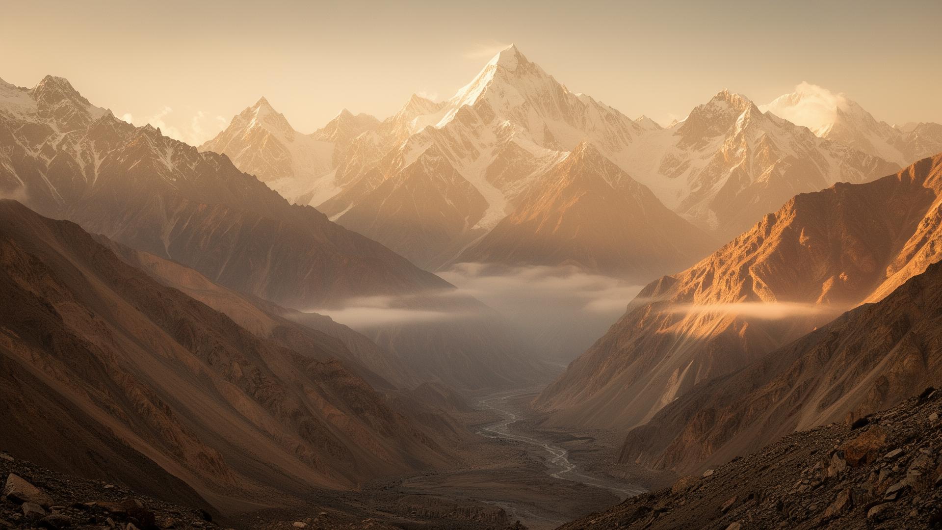
A two-lane paved highway through some of the steepest, most active terrain on earth, the convergence of the Karakoram, Himalaya and Hindu Kush ranges. Engineering-wise it is a triumph; weather-wise it is exposed; scenically it is unrivalled. The Chinese-built upper section (Gilgit to Khunjerab) was rebuilt and widened 2010-2019 to motorway-quality blacktop. The lower Pakistani section (Hasan Abdal to Gilgit) is mixed in quality depending on the district.
Section by section
- Hasan Abdal → Mansehra (~120 km, 2.5 hrs): motorway and dual carriageway. Easy.
- Mansehra → Besham (~140 km, 4 hrs): twisting, busy with trucks, paved. Tiring.
- Besham → Chilas (~210 km, 7 hrs): the Kohistan section. Narrow, exposed, slow. Never drive after dark.
- Chilas → Raikot → Gilgit (~190 km, 5 hrs): wide, fast, dramatic. Nanga Parbat off the right.
- Gilgit → Karimabad → Sost (~190 km, 5 hrs): the postcard section. Blacktop, smooth, jaw-dropping.
- Sost → Khunjerab (~80 km, 2 hrs): mountain pass to the Chinese border at 4,733 m.
Realistic driving times (private vehicle, daylight)
| Route | Driving time |
|---|---|
| Islamabad → Chilas (one day) | 9-11 hrs |
| Chilas → Gilgit | 3.5-4 hrs |
| Gilgit → Karimabad | 2.5-3 hrs |
| Karimabad → Sost | 3 hrs |
| Sost → Khunjerab (RT) | 5 hrs |
| Islamabad → Karimabad (split over 2 days) | 16-18 hrs total |
Where to break the journey
- Mansehra or Besham, pragmatic lunch stops; nothing scenic.
- Chilas (Shangrila Midway House), the standard overnight on the climb up. Hot in summer; basic but adequate.
- Raikot Bridge, turn-off for Fairy Meadows. Worth the photograph.
- Jaglot, the Junction Point viewpoint where the three great ranges meet.
- Karimabad, first real destination going up.
The real risks
- Driving at night through Kohistan, never. Truck traffic, narrow road, no margin. We end every day at a hotel before sunset on this section.
- Landslide season, July to early September monsoon edges can trigger landslides between Besham and Chilas. We monitor daily and reroute over Babusar Pass when possible.
- Road surface ice, the upper KKH and Khunjerab approach in October and again in May can have black ice in the early morning. Drivers know; passengers should not push for early starts.
- Other drivers, Pakistani truck culture is loud, fast and overtakes blind. Defensive driving is the local norm.
- Mountain sickness, Khunjerab is a drive-up to 4,733 m. Some clients feel mild AMS; we carry oxygen on every Khunjerab day.
Season and weather
- March-April: roads reopen progressively; Khunjerab usually opens 1 May.
- May-June: prime season. Clear, warm, full access.
- July-August: hot in lower sections, monsoon risk between Besham and Chilas. Babusar Pass open as alternate route.
- September-October: our favourite, clear, autumn colour, every pass still open.
- November: Khunjerab closes around the first week; KKH itself remains open year-round to Gilgit and Hunza.
Should you self-drive the KKH?
Practically: no. Mountain road norms are unfamiliar to most foreign drivers, the Kohistan section punishes hesitation, and a single closure can require local language and contacts to navigate. Every serious operator uses driver-included transport. Cyclists do ride the KKH every year and the experience is extraordinary; if that's your trip, talk to us, it's planned differently.
Q. Is the Karakoram Highway dangerous?
Dramatic, not categorically dangerous. The road is fully paved end to end. Two sections demand respect, Mansehra to Chilas in Kohistan, and any unmaintained stretch after a landslide event. We never drive Kohistan after dark and we monitor monsoon-edge weeks daily. With those rules, the road is no more dangerous than any major mountain highway in the Himalaya.
Q. How long does the KKH take from Islamabad to Hunza?
Roughly 14-18 hours of driving, almost always split across two days with an overnight in Chilas or Besham. We do not run it in a single day for clients, it ends with the driver tired in the most exposed section after dark.
Q. When is the Khunjerab Pass open?
Roughly 1 May to 30 November, weather depending. The pass is closed annually for snow clearance and re-opens for trade traffic first, foreign tourists shortly after. Always confirm before depending on it.
Q. Are there police checks on the KKH?
Yes, multiple, all routine. Have passport, visa and a printed itinerary copy ready. Most checks take 2 minutes; the few in Kohistan can take 15. Polite cooperation is the universal answer.
Q. Can I cycle the Karakoram Highway?
Yes, riders do it every year. Plan around weather windows, carry spares and water, and brief your operator for logistics support. Cycling Sost down to Hunza is an extraordinary three-day ride; cycling the whole KKH is a serious undertaking.
Written by
Zain Karim
Head of mountain operations
Zain has run private trips through Hunza, Skardu and the Karakoram since 2019. He spends about 120 nights a year above 2,500 m and writes about the routes he guides.
Has guided the Hunza-Skardu loop more than forty times.
More from Safety